Difference between revisions of "Server Development Environment"
(Created page with "==What is the purpose of the development environment?== Like many innovative projects, there needs to be a bit of testing. The development environment is a place to iron out a...") |
m (Minor tidying and rephrasing) |
||
| Line 1: | Line 1: | ||
==What is the purpose of the development environment?== | ==What is the purpose of the development environment?== | ||
| − | Like many innovative projects, there needs to be a bit of testing. The development environment is a place to iron out all the | + | |
| + | Like many innovative projects, there needs to be a bit of testing. The development environment is a place to iron out all the wrinkles in your system before it is moved to the [[Production Environment|Production Environment]]. The production environment is essentially fully developed ground stations that only require deploying; access to it is limited. This is not the case with the development environment. | ||
==How do I get access and create a ground station?== | ==How do I get access and create a ground station?== | ||
| − | The [https://network-dev.satnogs.org/ Development Network] has the usual sign up buttons | + | |
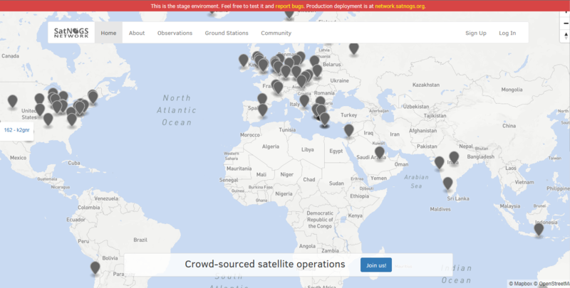
| + | The [https://network-dev.satnogs.org/ Development Network] has the usual sign up buttons. Create your account there and await confirmation. | ||
<p>[[File:Development network.png|center|800px]]</p> | <p>[[File:Development network.png|center|800px]]</p> | ||
===Creating a ground station=== | ===Creating a ground station=== | ||
| − | + | ||
| + | You'll need to provide some essential information about your ground station: | ||
| + | |||
<ul> | <ul> | ||
| − | <li>Where is the station | + | <li>Where is the station? We'll need the height above ground level and [https://en.wikipedia.org/wiki/Maidenhead_Locator_System maidenhead locator]?</li> |
| − | <li> | + | <li>Is the antenna static, or does it have a rotator?</li> |
<li>What type of antennas does the station have?</li> | <li>What type of antennas does the station have?</li> | ||
</ul> | </ul> | ||
| − | All this information is then | + | |
| + | All this information is then saved by the network, and used to determine which satellites can be received by your station. This will help other users to schedule passes on your ground station, but it can also help you improve your station. For example, perhaps you would like to receive the latest [https://en.wikipedia.org/wiki/Automatic_picture_transmission NOAA APT weather images] which are VHF transmissions. You could schedule an observation with your ground station and multiple other ground stations in order to determine if your set up has comparable performance. Without the station detail, this would not be possible. | ||
| + | |||
| + | The image below shows the web page for a typical ground station: | ||
<p>[[File:Dev_ground_station.PNG|center|800px]]</p> | <p>[[File:Dev_ground_station.PNG|center|800px]]</p> | ||
===Observing a pass=== | ===Observing a pass=== | ||
| − | The | + | |
| + | The central point of the system is the ability to schedule a pass. You'll find all the information about scheduling and how to assess the quality of the observation as part of [[Operation|scheduling your first observation]]. | ||
Revision as of 00:31, 28 December 2017
Contents
What is the purpose of the development environment?
Like many innovative projects, there needs to be a bit of testing. The development environment is a place to iron out all the wrinkles in your system before it is moved to the Production Environment. The production environment is essentially fully developed ground stations that only require deploying; access to it is limited. This is not the case with the development environment.
How do I get access and create a ground station?
The Development Network has the usual sign up buttons. Create your account there and await confirmation.
Creating a ground station
You'll need to provide some essential information about your ground station:
- Where is the station? We'll need the height above ground level and maidenhead locator?
- Is the antenna static, or does it have a rotator?
- What type of antennas does the station have?
All this information is then saved by the network, and used to determine which satellites can be received by your station. This will help other users to schedule passes on your ground station, but it can also help you improve your station. For example, perhaps you would like to receive the latest NOAA APT weather images which are VHF transmissions. You could schedule an observation with your ground station and multiple other ground stations in order to determine if your set up has comparable performance. Without the station detail, this would not be possible.
The image below shows the web page for a typical ground station:
Observing a pass
The central point of the system is the ability to schedule a pass. You'll find all the information about scheduling and how to assess the quality of the observation as part of scheduling your first observation.

